You know, in the constantly changing world of agriculture, precision farming is really making waves. It’s become a game-changer for boosting crop yields and making better use of resources. One of the coolest tools leading this charge is GPS INS guidance — basically, it combines GPS with Inertial Navigation Systems to keep everything on point when farmers are out in the field.
 At Poseidon International Group in Hong Kong, we’re all about pushing the envelope with cutting-edge tech like fiber optic gyroscopes and autonomous driving systems, paving the way for some pretty innovative farming solutions. Since we kicked things off back in 2013, we’ve been focused on conducting our own research and manufacturing, always working hard to get patents and stay ahead of the game. In this blog, I want to share five proven benefits of GPS INS guidance in precision farming—how these advanced systems can help farmers tackle common problems and make their lives a bit easier.
Understanding GPS Ins Guidance: A Game Changer for Precision Farming
So, if you’re into precision farming, you’ve probably noticed that understanding GPS INS guidance is a total game changer. Basically, by combining GPS tech with Inertial Navigation Systems (INS), farmers can get super accurate with their work—like, really on point. This combo makes it possible to position equipment with incredible precision, which means better planting, fertilizing, and harvesting. Here at Poseidon International Group, we’re all about creating advanced INS solutions that make farming more efficient. Our tech doesn’t just help streamline chores; it also promotes smarter, more sustainable use of resources.
If you're thinking about using GPS INS guidance in your farm, here are a few tips. First off, go for dependable sensors that give you trustworthy data—cheap ones won’t cut it if you want accuracy. Next, make sure to keep your software updated so you’re always using the latest navigation tech. And don’t be shy about reaching out to specialists—they can help customize solutions that fit your specific needs. Following these pointers could really boost your yields and make your farming operation much more efficient, setting you up for long-term success.
Enhancing Crop Yields Through Accurate Field Mapping with GPS Technology
GPS tech is really changing the game in precision farming. It helps farmers get super accurate maps of their fields, which means they can boost crop yields and be more efficient.
Thanks to satellite positioning, farmers can spot things like different soil types, moisture levels, and nutrient spots across their lands. This kind of data lets them target their actions—like applying fertilizers, pesticides, or watering—more precisely. As a result, crops get exactly what they need to grow their best, leading to better harvests and less waste.
And it's not just about mapping—it’s also a huge help for keeping track of crops during the season. With real-time info, farmers can check how their crops are doing health-wise and make smart decisions on the spot. This means they don’t have to blanket-treat their fields and can use resources smartly. The outcome? Healthier plants and a farming approach that’s better for the environment. As the industry keeps evolving, GPS technology is really stepping up as a key tool to boost productivity and help secure enough food for everyone down the line.
Cost Efficiency: How GPS Ins Guidance Reduces Farming Expenses
You know, incorporating GPS guidance systems into precision farming is really changing the game when it comes to how farmers manage their land. Honestly, it’s a huge boost for saving money. With GPS tech, farmers can cut down on overlapping passes in the fields—sometimes by as much as 90%! That means they’re spending way less on fuel and wasting fewer fertilizers and pesticides. It’s pretty awesome because it helps farmers save a ton of cash and use resources more wisely, without just throwing money away.
Plus, having GPS in agriculture makes everything more precise, which pretty much means better crop yields and smarter resource use. Thanks to real-time data and tracking systems, farmers can keep a closer eye on their fields and make better decisions based on what they see. It feels like we’re moving towards a future where farming isn’t just about working harder, but working smarter—doing better for the environment while also making sure it’s good for business. It’s exciting to see how these tech advancements are shaping the future of farming into something more sustainable and efficient.
Real-Time Data Analysis: Boosting Decision-Making in Precision Agriculture
You know, in today's fast-changing world of farming, using real-time data is pretty much a game-changer. I read somewhere that the precision agriculture market is expected to jump from about $7 billion in 2020 to nearly $13 billion by 2025—that's a solid growth rate of around 13%. It really shows how much farmers are relying on GPS and data insights these days to get better yields and work smarter, not harder.
What’s cool is that real-time analysis helps farmers make smarter choices on the spot—whether it’s checking soil moisture, crop health, or weather stuff. A report from the American Farm Bureau even points out that farms using GPS tech and analytics are seeing yields go up by about 10 to 15 percent compared to old-school methods. Plus, with GPS data, farmers can fine-tune how much fertilizer and pesticides they use, which means less waste and better environmental care. All in all, it’s a win-win—more profit, and more sustainable farming practices, which is what we need these days.
Sustainability Benefits: Minimizing Resource Wastage with GPS Insights
Precision farming really has shaken up agriculture. It’s all about helping farmers run their operations more smoothly, thanks to data-driven insights. One of the coolest parts about using GPS tech in farming is how much it promotes sustainability—by cutting down on wasted resources. Farmers can now keep close tabs on everything they use, from seeds to fertilizers, and apply these inputs more accurately. That means less waste and better crop yields, pretty awesome, right?
If you're looking to make the most of your resources, try using GPS mapping to analyze your soil in different parts of your fields. This way, you can do variable rate applications, putting your seeds, fertilizers, or water exactly where they’re needed most. And speaking of water, scheduling irrigation based on GPS info—like weather forecasts, soil moisture, and crop needs—can save you a ton of water and avoid runoff problems.
Plus, farmers are really benefiting from using GPS to monitor how their fields are doing. By updating their data regularly, they can spot areas that need extra attention—without overdoing it on pesticides or fertilizers. It's a smart way to stay ahead of issues, save resources, and keep the environment healthier overall. All in all, GPS technology makes farming more efficient and eco-friendly—what’s not to love?
Improving Soil Health: How GPS Technology Promotes Better Crop Management
You know, integrating GPS tech into precision farming has really been a game-changer when it comes to improving soil health and managing crops better. With all these advanced data collection tools now available, farmers can actually keep an eye on soil conditions with much more accuracy than before. I’ve seen reports suggesting that adopting these smart farming practices can boost crop yields by up to 20%! That’s mainly because they’re able to fine-tune how they manage soil nutrients and water. Plus, GPS systems make it a lot easier to apply fertilizers and pesticides just where they’re needed—so there's less waste and more sustainable farming overall.
On top of that, recent tech like autonomous tractors with GPS and AI are really ramping up efficiency on farms. These machines give farmers some pretty incredible insights into soil health, which helps them make smarter decisions about crop rotation, cover crops, and all those ecological practices we hear so much about. From what I’ve read, putting smart gadgets like drones and sensors into farms—especially in areas like the Visegrad countries—has really led to a boost in organic farming productivity. Using these tools doesn’t just make farm management easier; it’s also good for the environment. Overall, it really shows how GPS and related tech are playing a crucial role in making agriculture more sustainable for the long haul.
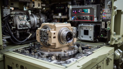
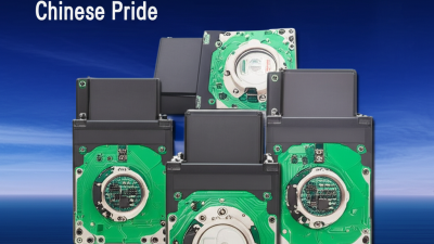
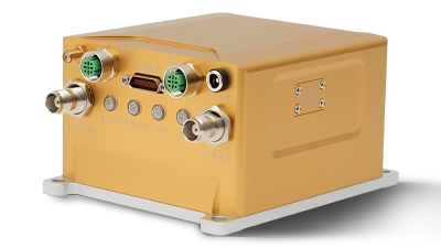
Maximize Precision in Navigation: Unveiling the GPS-Aided Sensor INS670 with Advanced Closed-Loop Fiber Optic Technologies
In the age of advanced navigation technologies, the Poseidon INS670 emerges as a breakthrough in high-precision integrated navigation systems. With its advanced closed-loop fiber optic gyroscopes (FOG) and MEMS accelerometers, the INS670 not only maximizes precision in navigation but also ensures unmatched reliability across various applications. This system supports multiple satellite navigation systems, including GPS, BDS, GLONASS, and Galileo, which collectively enhance its accuracy and performance.
The INS670 delivers real-time data on critical parameters such as heading, attitude, speed, position, angular rate, and acceleration. Its compact design and low power consumption make it an ideal choice for a wide array of navigation challenges, from vehicle and marine navigation to aerospace applications and UAV operations. Furthermore, the system’s compatibility with external sensors, like odometers and DVL, adds to its versatility, enabling seamless integration into existing platforms and environments.
With its multi-mode navigation capabilities and centimeter-level positioning precision, the Poseidon INS670 stands out as a robust solution for demanding applications in engineering surveying and beyond. Its ability to navigate through diverse environments with high accuracy ensures that professionals can rely on the INS670 to deliver exceptional performance, no matter the circumstances.
FAQS
: Real-time data analysis refers to the use of current data to make informed farming decisions regarding soil moisture, crop health, and weather conditions, which enhances farming efficiencies and productivity.
The precision agriculture market is expected to grow from $7.0 billion in 2020 to $12.9 billion by 2025, with a compound annual growth rate (CAGR) of 13.3%.
Farmers utilizing GPS technology and analytics can see an average yield increase of 10-15% compared to traditional farming methods.
Real-time data analysis allows farmers to optimize input applications like fertilizers and pesticides, reducing waste, minimizing environmental impacts, and promoting sustainable farming practices.
Farmers can use GPS mapping systems to analyze soil health for variable rate applications and schedule irrigation based on GPS data that monitors weather patterns and soil moisture levels.
GPS insights allow farmers to regularly update data to identify areas needing attention, preventing over-application of pesticides and fertilizers, which conserves resources and supports a healthier ecosystem.
Conclusion
GPS INS guidance is really shaking up the world of precision farming. It offers unmatched accuracy and makes everything way more efficient. For instance, being able to map out fields so precisely doesn’t just help boost crop yields—it also cuts down on farming costs. And with real-time data analysis, farmers can make smarter decisions on the fly, which means better productivity and smarter use of resources. Plus, the eco-friendly side of things is pretty cool—using GPS insights helps reduce resource waste and keeps farming more sustainable.
At Poseidon International Group, we’re all about cutting-edge tech like fiber optic gyroscopes and inertial navigation systems—key tools for bringing GPS INS guidance into agriculture. Our team’s expertise means farmers can enjoy healthier soils and better crop management, paving the way for a more productive and eco-friendly farming future.
 TBSD60
 BSD120
 BSD98
BSD98 BSD70
BSD70 BSD60
BSD60 BSD50
BSD50 BSD217
 INS1700
 INS970
 INS570
 INS170
 SLA-4B1L1-65
 SLA-4B1L1-130
 SLA-8B1L1-165
 DIVER 101
 DIVER 102
 DIVER 103
 DIVER 104
 DIVER 105
 DIVER 106
 SLLR3000
 SLLR905
 SLLD25
 160M
160M 170M
170M SLFC-70
 SLAF280
 MR360
MR360